John and Sarah Roberts, soon after their arrival in this country, it appears, first took up land on or near the mouth of Rancocus creek; but, being apparently dissatisfied with their location, afterwards secured a tract of two hundred and sixty-seven acres in extent, on the Pensauken creek, of which this spot is a part. As has been stated, they first lived in a cave on yonder knoll, which we are told they occupied until they were able to build a log house close by, afterwards building a more commodious dwelling, where the present house of John R. Mason now stands, a portion of which is still in existence.
-Excerpt from the ROBERTS MONUMENT BOOK printed in CAMDEN, N.J. by S. CHEW & SONS, PRINTERS, FRONT AND MARKET STREETS in 1899
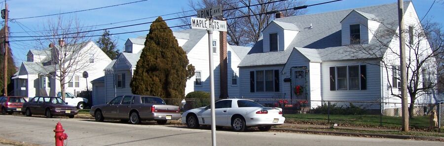
Where three Jack Jordon Capecods sit amongst Maple Heights Barlow bungalows was where the Roberts/ Lippincott/ Mason farmhouse once stood. Part of it was most likely from the 1700s. When you are on East Main Street, you realize that the peak of the hill is Pine Avenue, but actually the top of the hill is down South Pine Avenue where this house once stood.
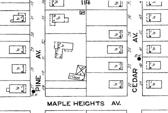
1923 Sanborn map showing farmhouse. The 1929 Sanborn also shows it. The 1944 Sanborn shows it gone and the lot vacant.
|
|
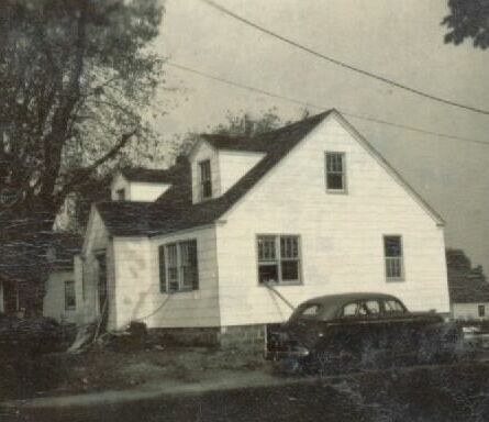
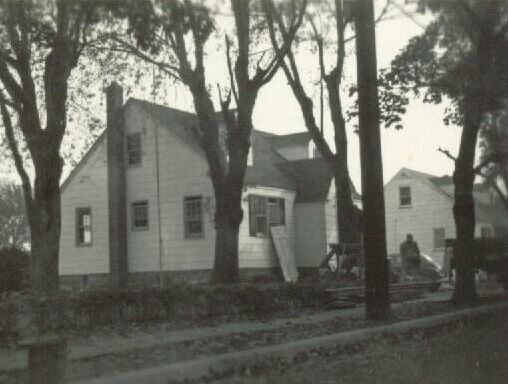
39 South Pine Avenue after some tree damage from Hurricane Hazel. Photos courtesy of the Setley family. These "Jack Jordon Capecods" filled many a lot in town about 1947, the land primarily bought from the Township. (Note still need info. on John "Jack" Jordon)
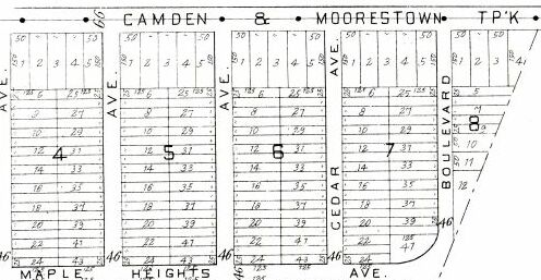
A portion of Maple Heights from the G.M. Hopkins 1907 Camden and the Environs Atlas. Maple Heights was layed out originally for twin or row homes.
The land to the right of this was sold by John R. Mason to the the Roberts family for the Roberts Monument and to Augustus Reeves for brickyard clay pits.
| Maple Heights | Map 714 | Filed on June 1, 1907 |
|
Plan of the Maple Heights Land Company of New Jersey
Located from Fellowship Road to a dividing line a block East of Boulevard Avenue, and from the Moorestown & Camden Turnpike (Main Street) to about where Route 73 is today. Note that Boulevard wraps around from (Main) to Fellowship. The Southern most part of Pine Ave. is named Barlow Ave. Previously The John and Margaret Mason farm, and before that Joseph W. Lippincott, a lineal descendant of the Roberts family. Mostly subdivided into 25 foot wide lots perhaps for twin houses or maybe even row homes. | ||
From the Roberts Monument Book, we read the earlier owners of the tract. (Note- the southern branch of the Pennsauken Creek area of Mill Road etc... was occupied by another branch of the Roberts family then the later names listed here.)-
The title deed recites further, that the one-eighth of an acre is a part of a tract of land that John Roberts took up from the Proprietors in 1682. He died in 1695, leaving his widow Sarah, and a son, John second, to whom at her death the property descended, and from John second to his son Joshua, and from him to his son William; from William to his son John G. Roberts. The property was sold to Joseph B. and Hephzibah Roberts Lippincott, (a daughter of William, and a sister of John G. Roberts) at whose death it descended to Joseph W. Lippincott, who by deed dated the 25th day of March, A.D. 1867, conveyed it to John R. Mason, in fee, which deed is recorded in Book P7 of Deeds, page 368, &c., in the clerk's office, at Mount Holly, N.J.
From the Country Gentleman, Volume 26, 1865-
The ad was in the Oct. 5, 1865 issue, page 232 and the Oct. 12, 1865 issue, page 247.
containing 92 1/2 acres of land, situated on the turnpike from Moorestown to Camden, (opposite Philadelphia) 2 miles from the former and 7 miles from the latter place, and a few rods from the Camden and Mt. Holly railroad, now being built. The Improvements are commodious two- story frame dwelling, divided into 11 rooms, with carriage- house, ice- house, 2 barns, hay- house, and a double cottage for workshop.
The land is beautifully rolling, has a fine front on two turnpike roads, and is in one of the highest situations in the county. The soil is a heavy loam, in a high state of cultivation, a large milk dairy having been kept thereon for some years past. A never- failing stream of water passes through the place.
There is a good stock of
and other FRUIT TREES, also
&c. Price $15,000, a large proportion of which may remain on mortgage. Apply to Joseph W. Lippincott,
No. 415 Walnut St., Philadelphia, or to JONATHAN G. WILLIAMS, near Moorestown. Oct. 5- w2t.
Here is quoted an old newspaper clip from Rebecca Matlack's 1909 Scrapbook, which is at the Moorestown Historical Society which reads-
Roberts Memorial Shaft Unveiled
[ Special to the Public Ledger ]
Moorestown, Nov. 15, - A monument to the memory of John and Sarah Roberts was unveiled yesterday on the Mason farm in Chester township, on the Camden and Moorestown turnpike, in the presence of about 100 descendants. The monument is a granite shaft 10 by 15 inches and 10 feet in height, and bears the following inscription: "John Roberts and Sarah, his wife, from Northamptonshire, England, 1677; settled here 1682; erected by descendants 1898."Elisha Roberts, 86 years of age, the oldest living descendant, was made Chairman, and Samuel Roberts, who bears the distinction of having been born and bred on the original tract, was made Secretary of the ceremony. The Misses Margaret F. Roberts and Anna Pasmore Sumner, each lineal descendants, about 10 years of age, pulled the cords unveiling the monument. Addresses were made by Elisha Roberts, Asa Matlack Stackhouse, David Roberts and Joseph W. Lippincott.
(Handwriting on the newspaper clip says "1898.")